
|
|
|
|
Industrial Regions 1960 |
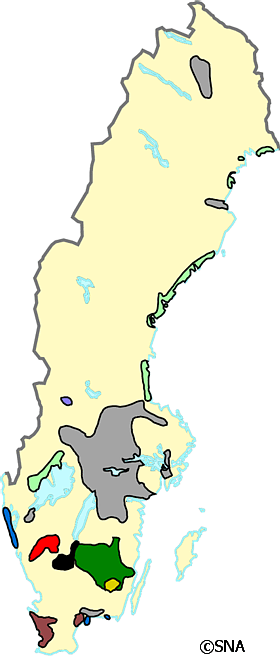 |
Industrial areas 1960 Today manufacturing industries are concentrated in large-scale plants but play a minor role in employment. Source: Map by Prof. W. William-Olsson, 1960 |
|
Based on the printed version of The National Atlas of Sweden:
Book : The EUGEO Selection (about the book)
Chapter: 3 Economy, Towns and Society Section: 3.1 Evolution of the National Economic Space |
|
Choose another theme (set of maps):
Search among the map titles:
|
Select other maps on
The EUGEO Selection (60 maps) |
|
Read more about SNA or send email to
[email protected].
Dynamically created 2006-09-25 using template updated 2003-04-07. |
